

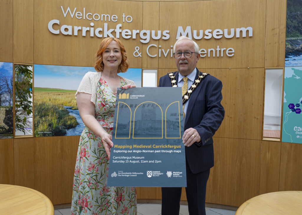
Free Carrickfergus Museum Event to Explore Town’s Anglo-Norman Past
♪
Listen to this article
Hear this story, then continue listening to NIO Radio.
Ready to play.
Article audio is not available in this browser.
Carrickfergus Museum will host a free workshop and illustrated talk on Saturday 15 August 2026. Visitors can explore an interactive digital map showing how Carrickfergus may have looked around 1250 AD. Advance booking is required for both sessions.
Carrickfergus Museum is inviting the public to explore the Anglo-Norman history of Carrickfergus during a free, one-day event on Saturday 15 August 2026.
The programme will combine archaeology, historic maps and modern digital mapping technology. Together, these resources will show how Carrickfergus developed over several centuries.
The event includes a practical mapping workshop in the morning and a visual lecture during the afternoon.
Explore Medieval Carrickfergus Through an Interactive Map
During the morning Mapping Workshop, visitors will learn how researchers created a new online map of medieval Carrickfergus.
Participants will also have an opportunity to test the map and explore its features.
The digital application aims to show how Carrickfergus may have appeared around 1250 AD. Researchers pieced the reconstruction together using historic maps, archaeological evidence and other available sources.
The wider project is a collaboration between:
- Mid and East Antrim Borough Council’s museum team
- Queen’s University Belfast
- The Heritage Council
- The Irish Walled Towns Network
The project will conclude during the European Year of the Normans in 2027.
Professor Keith Lilley to Deliver Afternoon Talk
Queen’s University Belfast geographer Professor Keith Lilley will lead an illustrated afternoon lecture titled Mapping Our Anglo-Norman Towns.
The presentation will use Carrickfergus and other Anglo-Norman settlements as examples. It will examine how maps can help researchers understand medieval towns and their development.
A question-and-answer discussion will follow the presentation.
Digital Technology Brings Carrickfergus History to Life
Mayor of Mid and East Antrim, Alderman Thomas Gordon, said the project offered residents and visitors a new way to discover the town’s history.
“Carrickfergus has a rich and fascinating history, and this innovative project offers a wonderful opportunity to bring the Anglo-Norman past to life for residents and visitors alike,” he said.
He added that the partnership between the council and Queen’s University combined academic research, archaeology and digital technology.
“The new digital map will give people a unique glimpse into what the town may have looked like around 1250 AD, offering an engaging and interactive way to connect with our past,” the Mayor said.
He encouraged anyone interested in local history, heritage or archaeology to attend and help test the new map.
Mapping the Anglo-Norman History of Carrickfergus
Carrickfergus is regarded as one of Ireland’s most important Norman heritage locations.
The earliest surviving map of the town dates from around 1560 AD. Researchers believe this map and later records reveal evidence of a medieval urban landscape that remains visible today.
The arrival of Anglo-Norman forces in Ireland began in 1169. The following period brought major political, military and social changes across the island.
Carrickfergus later developed around its castle, which was established by the Anglo-Norman knight John de Courcy during the late 12th century.
Find out more about Carrickfergus on our Town Page
Interactive Carrickfergus Map Planned for 2027 Exhibition
Organisers plan to make the interactive map available online.
It is also expected to become a touchscreen feature at Carrickfergus Museum during a new exhibition in 2027.
The exhibition will explore the arrival of the Anglo-Normans and the changes that followed across Carrickfergus and Ireland.
How to Attend the Free Carrickfergus Museum Event
The event takes place on:
Date: Saturday 15 August 2026
Venue: Carrickfergus Museum
Cost: Free
Sessions: Morning mapping workshop and afternoon illustrated talk
Book the Morning Mapping Workshop
To reserve a place at the morning session:
Email: carrickfergusmuseum@midandeastantrim.gov.uk
Telephone: 028 9335 8241
Book the Afternoon Lecture
Places for Professor Keith Lilley’s afternoon talk can be booked through the official Mid and East Antrim Borough Council website.
Anyone interested in Carrickfergus history, archaeology or digital heritage is encouraged to reserve a place early.
Local guide
Explore more in Carrickfergus
⌂
Carrickfergus hub
N
Carrickfergus news
E
Carrickfergus events
B
Carrickfergus businesses
F
Carrickfergus fuel prices
T
Traffic & travel
⚽
Carrickfergus Football
Explore Nearby Areas
More News


Where To Eat
Local guide
Explore more in Carrickfergus
⌂
Carrickfergus hub
N
Carrickfergus news
E
Carrickfergus events
B
Carrickfergus businesses
F
Carrickfergus fuel prices
T
Traffic & travel
⚽
Carrickfergus Football
Explore Nearby Areas